The Stony Shore maps are a series of three interconnected dungeon & cavern maps that were each drawn on a 14-inch wide by 6-inch tall canvas at 4 squares per inch. Called the Stony Shore because an underground river runs through much of the space in question, these three maps can be used independently, or combined into one 42-inch long by 6-inch tall piece. This is the third map in the set, which counter-intuitively is the left-most / west-most map.
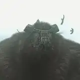
The western edge of the Stony Shore is also the southern face of the stony ridge that the caves are set within. Instead of entrances on the north side, here we have cave entrances (and arrow slits) looking down on the shoreline of the Grey Lake. The construction is evident here, with a fortified wall of heavy stone blocks set right beside one of the cave entrances. The majority of this area is caverns connecting to the other portions of the Stony Shore, including a large pool of pure crystal-clear water that supports no plant life at all.
The fortifications here are sealed off from the rest of the Stony Shore, with a well-hidden secret door and a fortified door at the top of some natural steps up from the gallery cave that leads out to the beach. They are maintained by a small team of guards from the nearby city as this is only a short distance down the shore from the main docks and allowing it to fall into bandit hands would be a problem – and the bandits operating out of the structures east of here don’t use this cave access anymore because of these guards.
The 1200 dpi versions of the map were drawn at a scale of 300 pixels per square and are 16,800 pixels (56 squares) wide. To use this with a VTT you would need to resize the squares to either 70 pixels (for 5′ squares) or 140 pixels (for the traditional 10′ squares) – so resizing the image to either 3,920 pixels wide or 7,840 pixels wide, respectively.
https://dysonlogos.blog/2023/06/12/the-stony-shore-map-3/