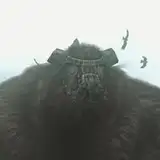
Two ancient domes behind a crumbling softstone wall are known just as “Bore Four-Four” to the locals. Once part of some deep-bore experiments where scientists were measuring solar ejecta from deep underground, the domes have become the headquarters of a well-equipped group of raiders / bandits. Both domes are made of a black-coated metal of some kind, with tinted crytalline panels on the upper dome to allow light it (the lower dome likely had these two, but the dome structure has been compromised and the panels are long gone.)
Access to the upper dome is only available via the lower dome – which is fairly easy to access as there are two breaches in the walls and the main doors don’t fully close anymore. The bandit/raiders generally ignore the bore holes except to throw garbage down them, and most live in the upper dome area where they are secure and have decent sunlight, trees, water piped up from deep underground, and a defensible single access point through the underground section to the first dome. A few bandits stay at the lower dome and a few more do routine patrols around the area, both within and outside the walls.
The 1200 dpi versions of the map were drawn at a scale of 300 pixels per square and are 9,600 pixels (32 squares) wide. To use this with a VTT you would need to resize the squares to either 70 pixels (for 5′ squares) or 140 pixels (for the traditional 10′ squares) – so resizing the image to either 2,240 pixels wide or 4,480 pixels wide, respectively.
https://dysonlogos.blog/2023/05/16/bore-facility-p44/