It has been a hectic few weeks since my last update, but I feel I say that nearly every update. Yesterday, I sat down and did some statistics on my trip thus far. In the 10 months I have been on the road, I have sat stiill for a total of 1.75 months. Between building out my second van in Flagstaff, Arizona after totalling my first one, and spending 3 weeks in Washington DC during the time of the inaugeration, I have been on the move for a solid 8 of those 10 months, moving nearly every day to a new location in search of photographs. Combining those 2 months of idle with the 8 months of consistant movement, I have averaged rougly 1,250 miles of traveled each week, every week, for all 10 months. Thats a lot of movement, and a lot of time spent searching for locations. Sometimes, it burns me out to the point I want to give up. Other times, a smarter sense creeps in, and I listen to my body telling me to sit still and rest. That is what I am doing now.
After my last update, in a panic, I began making my way out of Oregon and into Washington state in hopes of avoiding the historic, once in a millinium heatwave expected to land in the Pacific Northwest. First making my way towards the western edge of the Olympic National Park, on the far northwestern tip of the state, I was greeted by reality. With the heat dome approaching, the entire coastal region was swamped with families hoping to get out of their homes. Western Washington homes, like much of the Pacific North West, don't use air conditioning in their households. Tempreatures like those approaching are so uncommon, nobody was prepared for the impact. The beaches filled with people, the campsites were all full and reserved. Every hotel was booked and/or gouging from the opportunity. After a few days of the crowds, and once leaving to get supplies just to return and fight my campspot taken, I knew it was time to go.
I made my way east, scooping under Seattle and towards North Cascades National Park. Located in the northern center of the state, I was contacted by a friend who offered a place to shelter. Unknowing to me, this home did not have A/C either, and was located in the middle of a valley, the worst place to be during an extreme weather situation. With every 1,000 feet of elevational change, that presents roughly 5 degrees of temperature variance. When arriving, and it being 99 on the ground already, before the heatwave had truly began, I knew it was time to figure out yet another place. Luckily Northern Cascades National Park is a section of the Cascade Mountain Ranger, offering lengthy climbs in elevation. From the small town of Marble Mount, Freedom and I set off to scope and prepare for what was coming in the following days. Eventually, we made our plan. We would spend the days at the top of Washington Pass, the highest mountain pass within the park, maxing out at 5,476 feet and a stark comparison to the 322 of Marblemound. We spent that evening and the next day using the elevation, glacier fed waterfalls and shade from the mountains to keep cool before lady unluck struck. On the hottest day in recorded history for region, reaching nearly 110 in the valley below, the Washington Department of Transportation decided it would be the perfect time to pave the exact section of road I had scoped out and sheltered in for the past 2 days. No more using the radius of the waterfall as natures AC. It was time to move.
With the wrench in our plans, we once again found ourselves in the valley below, but this time on the other side of the range in the small town of Winthrop. Going through nearly a tank of gasoline a day simply by running the van full time to keep Freedom cool, and searching for a new plan, I finally found a solution. A nice gentleman who owned the small community gas station had given me a small map of the area. From there I was able to piece together a series of backroads that would lead us high into the sky and away from the scorching earth below. We eventually found ourselves on top of Sweetgrass Butte, a radio tower location perched 6,400 feet in the air, offering a beautiful view of the mountains all around and a nearly 20 degree relief from the town below.
By this point, my van was about fed up with me. Between being on for nearly 18 hours a day, and pushing her into mountainous terrain in extreme heat, she began getting tired. She started having issues starting and was making weird noises when idling. That last thing I wanted to do was be stuck 30 miles down a dirt road, on top of a mountain, in a heatwave, with a dead van. Waking up the next morning on top of the Sweetgrass Butte and realizing there was still a 5 day span of 100 degree weather expected in the area, I decided it was best to retreat from the area and head towards the coast. By this point the marine layer of air had moved into the coast, offering the water as a refuge from the heat dome that had centered itself directly where we were located. We climbed down the mountain, filled up one last time and headed towards Whidbey Island a nice area located just north of Seattle and east of Orca Islands, about 40 miles from Canada.
WHAT A RELIEF
After scouting the area for while, I eventually found a killer spot. Right outside Ebby's Landing, a coastal State Park was a small strip of coastline, just alongside a small road was a popular van life landing point right on the water. With the nearby state park filling up during the day, I spent the next few days and nights sitting still, decompressing from the intense week before and cooking. My friend Cody took the ferry over from Seattle for a day and camped alongside us. It was nice to see a familiar face and finally get some relief from the heat. By this point however, I hadn't done much photography. Most of the previous days had simply been focused on keeping my dog safe and cool while keeping myself sane. After 3 days of relaxing it was time to move on.
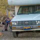
It was time to figure out what was happening with my van. Turns out I just needed to replace the battery, as it was worn down from the heat and stress. I went ahead and rotated the tires, got an oil change and all fluids topped off just to get her back up to speed. Now, it was time to get back to photography.
Heading south, I decided it was time to focus my attention, and lens on Mount Rainier National Park. Making my way down, I began approaching the park from the Northwest. Stopping about an hour short outside the park in the small town of Green Water for the night. Climbing and searching a few forest roads, I eventually found a great elevated road that gave me a perfect view of the peak of Rainier and the valleys before. Probably about 30-40 miles away. Settling in for the night, I photographed sunset and the following sunrise before continuing on path. I regret not spending more time at that location, because I was soon reminded what National Parks are like at the moment. North Cascades was different, because its actually the least visited NP in the continental US, but Rainier? Thats another story.
It was a Tuesday and Paradise, one of the parks leading headquarters was jammed packed. Talking circling the van in an hour just to find a parking spot packed. On a Tuesday. I was getting stressed out again, so decided to retreat. Heading south towards Longmire and out of the park, I passed Cougar Rock a small campsite still within the limits of the park itself. I had lucked out, as there was still a couple spots available. Now, usually my rule is I don't pay for campsites, but I still wanted to explore the area somewhat and frankly, I was exhausted, so I paid the fair $20 a night and decided to spend the next 3 nights there. I spent following days trying to be productive. I made did some exploring in the afternoons, and used the mornings to handle van life business and spent an entire day printing out photographs. One of the days I spent 6 straight hours detailing the entire inside of my van. Everything was taken out, wiped down and cleaned. Even the cracks in the doors. You couldn't tell now, as 20 minutes of living in a van results in hurricane resemblance conditions, but I did it. It felt good to do it, too!
After the Rainier and being in the area, I really wanted to stay in a hotel for a couple days. Getting off the road is important, if even for a moment. Its so hard to access reliable wifi while traveling at this speed, so I made the trek out of the park and all the way to Tacoma to try and line up a hotel, but no luck. Everything in the area was booked up for the weekend except for a few slimy hotels that made it clear that break ins were a problem. With living in a van, and having my entire life in it, I couldn't even take that risk. Instead, I started making my way back towards the southern end of Rainier again, this time settling in for a couple days at a RV park in the tiny town of Cougar. As much as I despised paying to camp at an RV location, I needed wifi and there once again was not a lick of reception around. Paying $130 for 2 nights, I was able to finally package and organize all the prints for photo club.
From there, I made my way south. With Rainer photographed, it set my sites on Mount Saint Helen. Leaning from Rainier that its much easier to photograph volcanoes from a distance, I spent much of my time in the area searching whatever I could to get a distance shot of the mountain. Now Rainier is fairly easy to photograph as there is a large selection of nearby forest roads outside the park, but Mount Saint Helen is a completely different scenario. Mount Saint Helen, the most active and dangerous volcanoe in the continental US is very difficult to photograph from a unique perspective. Since it carries so much danger of eruption, similar to the historic 1980 eruption, all life near the volcano itself is pretty slow. I eventually, after 3 days, made my way up to Johnston Ridge Oberservatory to photograph. I pretty touristy spot, but also offers the best view inside the crator. Luckily for me, that night happened to be an evening where the Milky Way aligned directly behind the volcano itself. After staying up until 2am that night, I eventually made it awake by 4:30am to photograph from the road again on the way down for sunrise.
Which more or less leads me to where I am now, writing this.
I hope this helps everyone catch up to speed with what I have been up to the last few weeks. Its been stressful at times, and very busy, but I am thankful for it all regardless.
I will update in a couple days with some new news on other projects I have going on while doing all this, but wanted to share some images from the latest journey. Some may have been shared before on social media, but many are not.
(PHOTOS BELOW)
PS. Also sorry for the long winded and sloppy written post. I just wanted to get it all out!
love yall!
-Ryan
 (Mount Saint Helens: Early morning fog sweepingly puddles the valley below Mt. St. Helens)
 (Sunset falls on Mount Rainier from Forest Service road 72, just outside of Greenwater, Washington)
 (Clouds pass through Olympic National Park, Port Angeles - Washington)
 (Early morning fog - Beach 3 - Olympic National Park)
 (Sunset over Lake Quinault - Washington)
 (Headlights illuminate the asphalt of highway 101)
 (Peaks and glaciers of Mount Rainier loom over nearby forest - Mount Rainier National Park)
 (Valley sunset - Mountain Rainier National Park)
 (Mount Rainier - Greenwater, Washington)
 (Milky Way & airglow make an appearance above Mount Saint Helens)
 (Sunset - Cape Deception, Washington)
 (Olympic National Park, Washington)
 (Trump sign & country barn - backroads, Washington)
 (Sunset - Lake Quinault, Washington)
 (Sunrise over Mount Rainier - White Pass, Washington)

(Glacier fed waterfall over Washington Pass - North Cascades National Park, Washington)
 (Sweetgrass Butte - Washington)
 (Space Needle - Seattle Washington)
Avril Williams
2021-08-01 23:31:05 +0000 UTCMerja Ellefson
2021-07-17 07:42:41 +0000 UTC