XaiJu
Nate Mangion
Nate Mangion

patreon


BONUS: City WIP

I thought I'd share a WIP of the city-map I'm working on with my patrons - as a sneak peak to my loyal followers/acolytes/shapers/demiurges, and to get feedback.

The gist of it is there, and I don't see the final thing changing much from this. Some details:   - government/religious buildings are black. Should I make these different colours to further differentiate them from each other?  
- normal buildings are hatched brown/orange. Should I add a different colour to distingusih industrial buildings from residential and commercial ones?
- fortifications will have brown inner glows to make them pop a bit more.  
- everything else should be pretty self-explanatory.  

I still need to add:
- street names and all other form of labels
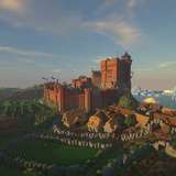
- a different cartouche - possibly bigger with more information, like population, main industries, and certain demographics. Any suggestions for what can go in the cartouche? - Texture? The atlas maps have a slight bevel/emboss on the land to give the impression of terrain. Should I do anything here? keeping in mind I want to keep as much of a classical look about these maps as possible (see the attached map for what I'm aiming for) and want to avoid them looking too digital while still keeping them similar in style to the atlas maps (keeping in mind that these will be part of the same Atlas), so while they may not share the same colours there need to be certain design similarities that tie these and the nation maps together.    

If you have any suggestions please don't hesitate to let me know! Thanks again for your support :)   


BONUS: City WIP

Comments

Oh yes, the same as current maps, with hd versions and textless ones too.

Nate Mangion

This is a very appealing style. Actually not that different form my own tries so far. Are finished citymaps also gonna be available to your patreons?

DungeonQuill

It's not it has a lot, Trieste is like you said, but on the right it has some

Impesio

cities with lots of hills will have lots of curved streets and very few grids (or if they do they will have lots of stairs like the capital of my home, Valletta.

Nate Mangion

Yeah. Demititans rule over Xaanthia, they became very rationalistic, but Xaanthia has it topology, but I think I didn't managed to express the concept as you did here. Much less

Impesio

ys, most roman colonies built from scratch were built on a grid pattern because they were designed - these type of cities ar what i refer to as new cities, or more precisely - designed cities. by comparison, a map of the ancient city of Rome, which evolved organically over hundreds of years, has few if any grids, because.

Nate Mangion

Take a look of the roman Barcelona, This is a roman grid, much more perfect than one could think. It was a roman Castrum. Castrum Tarraco The fact is that Even Grid cities are subject to topology, so is that what should make them interesting

Impesio

thanks - im not 100% sold on it either

Nate Mangion

i think it might also come down to personal tastes - I'm not q big fan of rid cities - as they look boring but some cities are just made that way. i think id need to find ways to make them seem more interesting (some diagonal grids intersecting the others, for instance)

Nate Mangion

The only thing I do nnot like very much is that the brown is too brown

Impesio

Yes, I know this, but there is a lot of ability in "making seem that is like that" In my particular case, The fact that the left are more random do not apply in all "older cities". In fact it's a medieval heritage, where the street had a part in the city defence to make the invader lost. In the particular case of Xaanthia, the city has a grid city layout abecause they are rationalistic people and are governed by such rationalistic minds. Even the romans had a Grid approach in city layout. But that sayd, your grid is much more realistic than mine xD

Impesio

I can't download it becouse I do not have a scribd subscription xD

Impesio

i found the book here in pdf form, if you have scribd - <a href="https://www.scribd.com/document/334282120/THE-CITY-SHAPED-pdf" rel="nofollow noopener" target="_blank">https://www.scribd.com/document/334282120/THE-CITY-SHAPED-pdf</a>

Nate Mangion

i have quite a few books on the subject as theres a lot of planning that goes into making city maps look realistic - you cant just place streets at random if you take my example above - the streets to the right are different to those on the left. The ones on the right are more like a grid and the one son the left are more 'random' why? generally modern cities that were planned (rather than which grew organically over time) tend to have streets designed in a simple grid. older cities, that tend to have more haphazard streets as people just built buildings with little thought given to planning. In the above map i decided the old part of the city is the middle /left and made the street more random accordingly. the newer part of the city is in the top right, so the streets are more grid-like. it's also no mistake that the church is close to the old part of the city. my biggest recommendation for city planning and history is - <a href="https://www.bookdepository.com/City-Shaped-Spiro-Kostof/9780500280997?ref=grid-view&qid=1546684187127&sr=1-1" rel="nofollow noopener" target="_blank">https://www.bookdepository.com/City-Shaped-Spiro-Kostof/9780500280997?ref=grid-view&qid=1546684187127&sr=1-1</a>

Nate Mangion

After seeing this my city map's streets seem shitty and too much unrealistic xD

Impesio


More Creators