Geotiff and Worldpainter data - Japan 30m resolution [40k]
Added 2024-02-28 13:42:50 +0000 UTCThank you for subscribing Top Tier membership!
Here come the details of the data used to make Japan map at a resolution of 30m [40000x40000] (MC Real World Maps - Japan 30m resolution [40k]):
DEM data

Biomes map

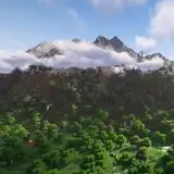
Biomes map zoom over Mount Fuji

Data used:
- Japan’s Geospatial Information Authority 10m DEM data - cubic reinterpolation to 30m
- GEBCO 15arcsec resolution bathymetric data - cubic reinterpolation to 30m
- Japan Aerospace Exploration Agency 10m LAND COVER data for coasts, rivers and lakes - cubic reinterpolation to 30m
Downloads:
WorldPainter .world file at 30m resolution [47000x43000]:
https://drive.google.com/file/d/1EF9eLUdZ6VibIWCbYamZmMp7FLesh3bJ/view?usp=sharing
Merged DEM & Bathymetry data in Geotiff format at 30m resolution [47000x43000]:
https://drive.google.com/file/d/10CEt6KaRZ13Br2PrBqXBbcCW4VDmXRJA/view?usp=sharing