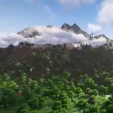
Geotiff and Worldpainter data - Sydney 5m resolution [16k]
Added 2024-02-25 01:06:02 +0000 UTCThank you for subscribing Top Tier membership!
Here come the details of the data used to make Sydney Map at 5m resolution [16k] (https://www.patreon.com/posts/mc-real-world-5m-99090328?utm_medium=clipboard_copy&utm_source=copyLink&utm_campaign=postshare_creator&utm_content=join_link):
Biomes map

DEM data

Data used:
- NSW Government - Spatial Services 1 and 2 meters data for Sydney City - cubic reinterpolation to 5m
- Geoscience Australia 2015 5 meters data for areas outside Sydney City
- GEBCO 15arcsec resolution bathymetric data - cubic reinterpolation to 5m
- IGISMAP data for coasts - rasterization at 5m resolution
- Geoscience Australia - Surface Hydrology Polygons for rivers and lakes - rasterization at 5m resolution
Downloads:
WorldPainter .world file at 5m resolution [16304 x 15587]:
https://drive.google.com/file/d/1dbf59DTFC5F8vpNlZ60Qy-JM7tJi6djV/view?usp=sharing
Merged DEM & Bathymetry data in Geotiff format at 5m resolution [16304 x 15587]:
https://drive.google.com/file/d/1nR34YvZ9eGfFu-QMP3q9WZP95iCvOx0-/view?usp=sharing