XaiJu
Aonbarr Cartography
Aonbarr Cartography

patreon


Going Forward - Patron Feedback Requested!

Hi folks!

I'm just posting to give you, my Patrons, an opportunity to voice your opinions on a few things.

I've spoken to some of the folk in the Curse of Strahd Discord, and they had some suggestions for how to proceed with my maps going forward. If you have any other ideas (or any concerns regarding the ideas below), please share them!


To summarize:

1: I may switch from PNG to WebP format.
2: I may reduce the pixel count from 256 pixels to 128 across all maps.
3: I may adjust the environmental lighting, and provide a variant with no lighting whatsoever.
4: I may start including map sizes in the file names for convenience, unless it's deemed that the titles would then be too unwieldy.


To elaborate:

1: I may begin exporting my maps in WebP format, as this is a smaller file size than PNG. This will save on storage space, and it should save me time when it comes to exporting maps. I don't know what to do with regards Roll20, however, since it doesn't support WebP format, but it also has a 10MB upload limit for free accounts anyway, so a lot of my 70px PNG maps would need to be compressed regardless. Anybody have any thoughts for how to address that specifically?

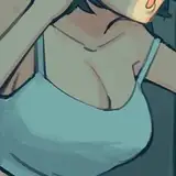
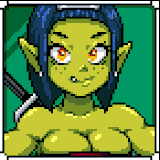
2: The maps that are 256 pixels per square take up a lot of space and it's a level of detail that may not be necessary for VTTs anyway - lowering the pixel count to, for example 128 per square, will cut down file sizes further. I'm including images in this post that will allow you to compare the pixel counts, just so you know exactly how much information we'd be losing by dropping to 128 (and in the changeover to WebP format). In saying that, I have to export most maps that have more than 50 squares in any direction at 128 pixels per square anyway, as otherwise, Dungeondraft refuses to export the files for me. So, this would just make the full size maps more consistent.

3: The maps are very dark - this is an intentional choice on my part, but does have certain drawbacks. Primarily, if your viewing conditions aren't ideal, the maps can quite easily become illegible. The darker the map's starting point, the less useful Foundry's Day/Night cycle will prove (and since many of my Patrons appear to use Foundry, this isn't ideal). As such, I'm going to experiment with changing the environmental lighting effects - hopefully it works out, but if not, I might also supply versions of the maps that have no lighting effects whatsoever, to give you more control on the maps.


The files I've attached to this post should give you an example of the quality and size of the different file types - please feel free to check them out and let me know what you think!

Going Forward - Patron Feedback Requested!

Comments

Yeah, I definitely like the idea of making token style assets available for vehicles and whatnot, and I did actually do that with both versions of my Lake Zarovich maps. I kind of regret not doing it for the Vistani Camp, but I'm probably going to do it with Ezmerelda's wagon when I get to Van Richten's Tower - I already have a prefab for a Vistani wagon's interior, so I'd just need to make some changes to that and I should be good to go! I did consider switching to sharing ZIP files instead, but it turns out there's actually a size limit for Patreon uploads and a lot of my maps go over that limit (they are ridiculous - hence the desire to switch to a smaller file size). Once I switch to more manageable sizes and formats, though, zip files might be easier to implement. I'm probably going to have to re-export my maps using the new approach anyway, so I can probably try switching over then. I've been sharing the Drive folder for months though, so I might have to keep that online for a bit after the change anyway. I think you are on to something with regards trying to find a focal point for the map, and I think that ties into some of our previous conversations with regards making maps eye-catching. I'll try to experiment more with highlighting the important areas and see what comes out of it - hopefully that'll help to maintain the gloomy element while also making the maps both more eye-catching and practical! Thank you Andy - as always, I really appreciate it!

Vincent - Aonbarr Cartography

I am not familiar with .webp files but I typically export my maps as a jpg. When I create assets that can be moved around the map (Vistani wagons, roofs, etc) I will create those as .png files. I know Roll20 has a 10mb limit and I have their top tier sub. I think it might be 5mb for their free sub but don't quote me on that one. If storage space is a concern for you, have you considered just attaching .zip files to your posts with your maps? This way you don't have to host them (though it's always a good idea to have cloud backup of your files). Regarding the darkness of your maps.. this is still a challenge I face as well. Barovia is a dark and spooky place.. but at the same time we want players to be wow'ed by an awesome map and we don't want the details to be hidden under that darkness. So the goal is to create a dark "bright" map which I'm still working on trying to achieve. I like the darkness of your maps personally and they should be gloomy, but maybe instead of lightening up the entire map, pick a focal point (a building or a road) with a brighter, more contrasting color. Something that draws the players eye to it as the main center piece of the map but also gives them the illusion of encroaching darkness. Either way, it is an extremely hard skill that I have not even come close to mastering! " Keep up the great work. I think your maps are great and they continue to get better and better.

Andy D'Amato

You're very welcome, Hannes - thanks for weighing in!

Vincent - Aonbarr Cartography

1: using foundry and import them via .2ddwhatevertheendingis so I cannot give an opinion here 2: 128 will be enough for me 3: Yes please - I am using the dark/night feature and only download the day maps anyway 4: all good - I do not mind map sizes in the names thanks for doing these maps (for me, it‘s a game changer and saves a ton of time!) and thanks for being open for discussion :)

Hannes Birnkammerer


More Creators